Touring Martinique by car in a single day is a myth. The island is only 80 km long and 39 km wide, but its winding mountain roads, roundabouts and the traffic jams around Fort-de-France dramatically stretch real drive times. After several years criss-crossing these roads, I’m offering you a far more satisfying approach: three themed loops, one day each, designed to minimize driving and maximize the stops that matter.
Each loop starts from the Trois-Îlets / Fort-de-France area (where most of our travelers stay) and returns in the evening. The times shown are honest driving times, not optimistic GPS estimates under the midday sun.
Before you take the wheel: the golden rules
A car is essential in Martinique: public transport remains limited outside the urban area. A few concrete pointers before you set off:
- Fuel: budget around €1.75 to €1.85/L for unleaded (2026). Fill up the day before, as stations become scarce in the deep North and South.
- Fort-de-France traffic jams: the A1 motorway and the area around Le Lamentin are saturated from 6:30 to 8:30 a.m. and from 4 to 6:30 p.m. Avoid crossing FDF at those times, even if it means pushing your departure to 9 a.m.
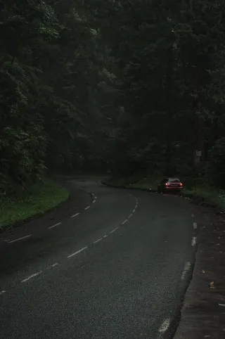
- Driving: narrow, twisty roads in the North. Allow plenty of time and don’t take Google Maps literally.
- Best time to go: the dry season (Carême), from December to April, offers the most drivable roads and the most beautiful light. Carnival (February-March) occasionally shuts down town centers.
To prepare your stay more broadly, our Martinique guide covers climate, budget and logistics.
Loop 1 — Caribbean North: Pelée, Saint-Pierre and agricultural rum
This is my favorite loop, the most spectacular. A volcano, UNESCO-listed ruins and legendary distilleries on the leeward coast.
Itinerary and drive times
Trois-Îlets → Fort-de-France → Jardin de Balata → Saint-Pierre → Le Carbet → return.
- Trois-Îlets → Jardin de Balata: 45 min (go before 9 a.m. to avoid FDF)
- Balata → Saint-Pierre via the Route de la Trace: 1 hr of magnificent bends
- Saint-Pierre → back to Trois-Îlets: 1 hr 15 min
Total driving: about 3 hr 15 min over the day.
The stops worth the detour
- Jardin de Balata (entry ~€16): 30 to 45 min of botanical strolling and suspended bridges.
- Saint-Pierre: the ruins of the theater and Cyparis’s dungeon, the only survivor of the 1902 eruption. Allow 1 hr.
- Distillerie Depaz, at the foot of Montagne Pelée: free tasting of AOC agricultural rum in a superb setting.
Lunch break
On the Saint-Pierre seafront, several spots serve a grilled fish / accras menu for around €18 to €25. Book ahead or arrive before 12:30 p.m., as it fills up fast.
Fuel
Fill up in Schoelcher before tackling the Trace: the next reliable station is in Saint-Pierre.
Loop 2 — Southern beaches: Les Salines, Diamant and black-sand coves
The easiest loop to drive and the most postcard-perfect. Ideal early in your stay to get into the mood.
Itinerary and drive times
Trois-Îlets → Anse Dufour / Anse Noire → Le Diamant → Sainte-Anne (Les Salines) → return.
- Trois-Îlets → Anse Dufour: 25 min
- Anse Dufour → Le Diamant: 30 min
- Le Diamant → Les Salines (Sainte-Anne): 40 min
- Les Salines → back to Trois-Îlets: 45 min
Total driving: about 2 hr 20 min. This is the least tiring loop.
The stops worth the detour
- Anse Dufour and Anse Noire: two neighboring coves, one of pale sand, the other of volcanic black sand. Snorkeling with turtles in the morning. Limited parking, arrive early.
- Le Diamant: a long beach facing the famous Diamond Rock. Beautiful view, sometimes a stiff wind.
- Les Salines at Sainte-Anne: THE island’s iconic beach, coconut palms and turquoise water. Arrive before 10 a.m., as the parking fills up on weekends.
Lunch break
At the entrance to Les Salines, the local stands’ bokits and grilled fish cost €8 to €15. For a proper restaurant, the village of Sainte-Anne offers Creole spots around €20.
Fuel and parking tip
Fill up as you leave Trois-Îlets. At Les Salines, leave nothing visible in the car.